Reducing greenhouse gas emissions in peatlands
Deltares has teamed up with a range of partners to launch a programme for monitoring greenhouse gas emissions in peatlands. The results can be used to devise ways of cutting these carbon emissions. Carbon emissions and land subsidence go hand in hand in peatlands.
The Netherlands has been affected by land subsidence for more than a millennium. In recent decades, the phenomenon has been causing more and more damage in the form of subsiding houses and broken sewers. “The land is sinking because of natural and human causes,” explains Deltares researcher Gilles Erkens. “At the moment, the natural causes account for about 0.3 millimetres of subsidence a year. Human factors account for between 1 and 10 millimetres a year. Gas extraction or salt mining play a role but so do draining or loads on ‘soft’ clay and peat soils.”
Supersized peat samples for subsidence predictions
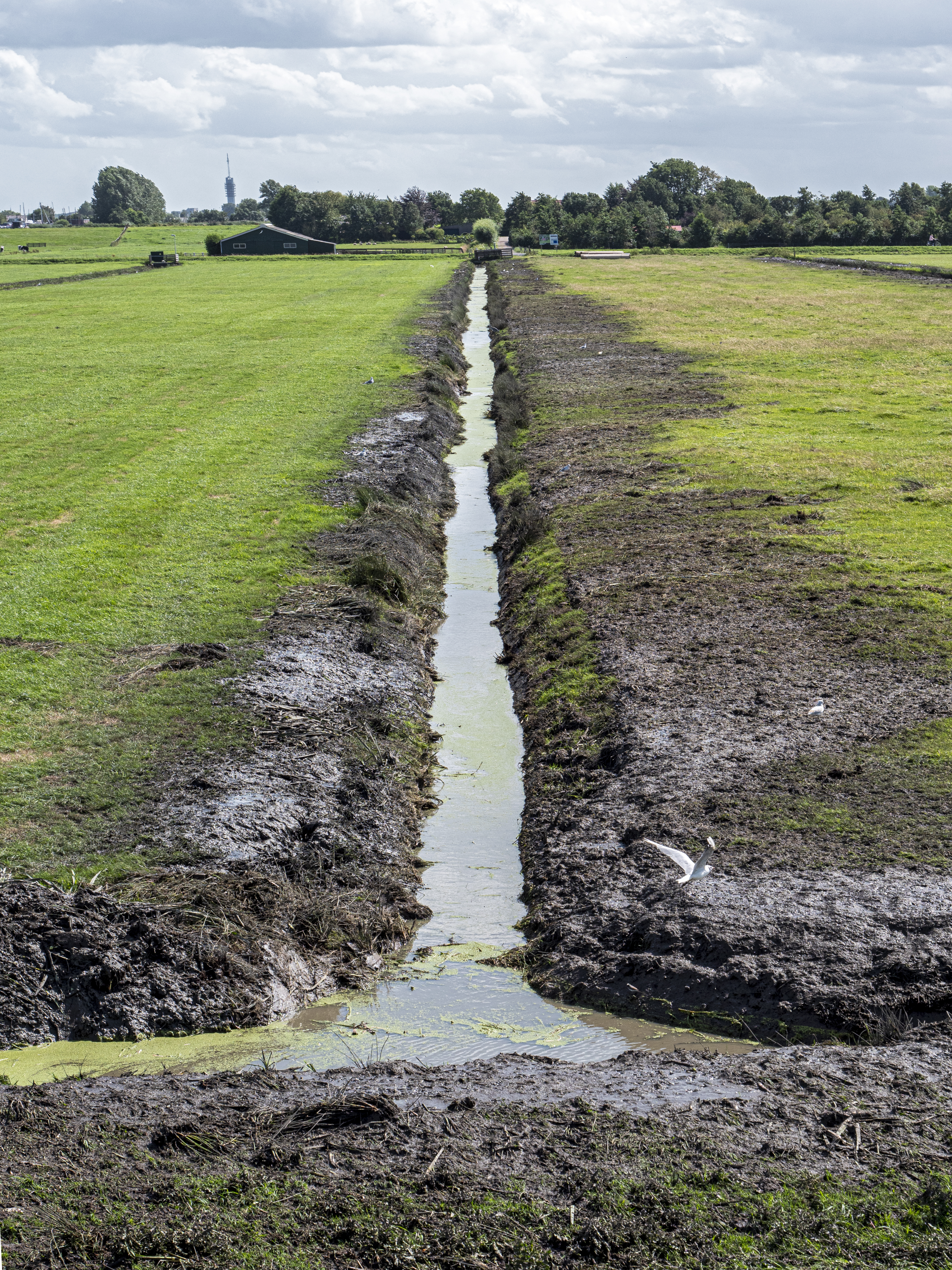
In these peatland areas, land subsidence has another effect: it leads to greenhouse gas emissions. Erkens: “In drained peatlands, microbes ‘eat’ the peat and, in the process, emit CO2.” In the Netherlands, that process accounts for 2 to 3 percent of total greenhouse gas emissions. The goals of the climate agreement mean that slowing down emissions, and therefore land subsidence, is a pressing issue.
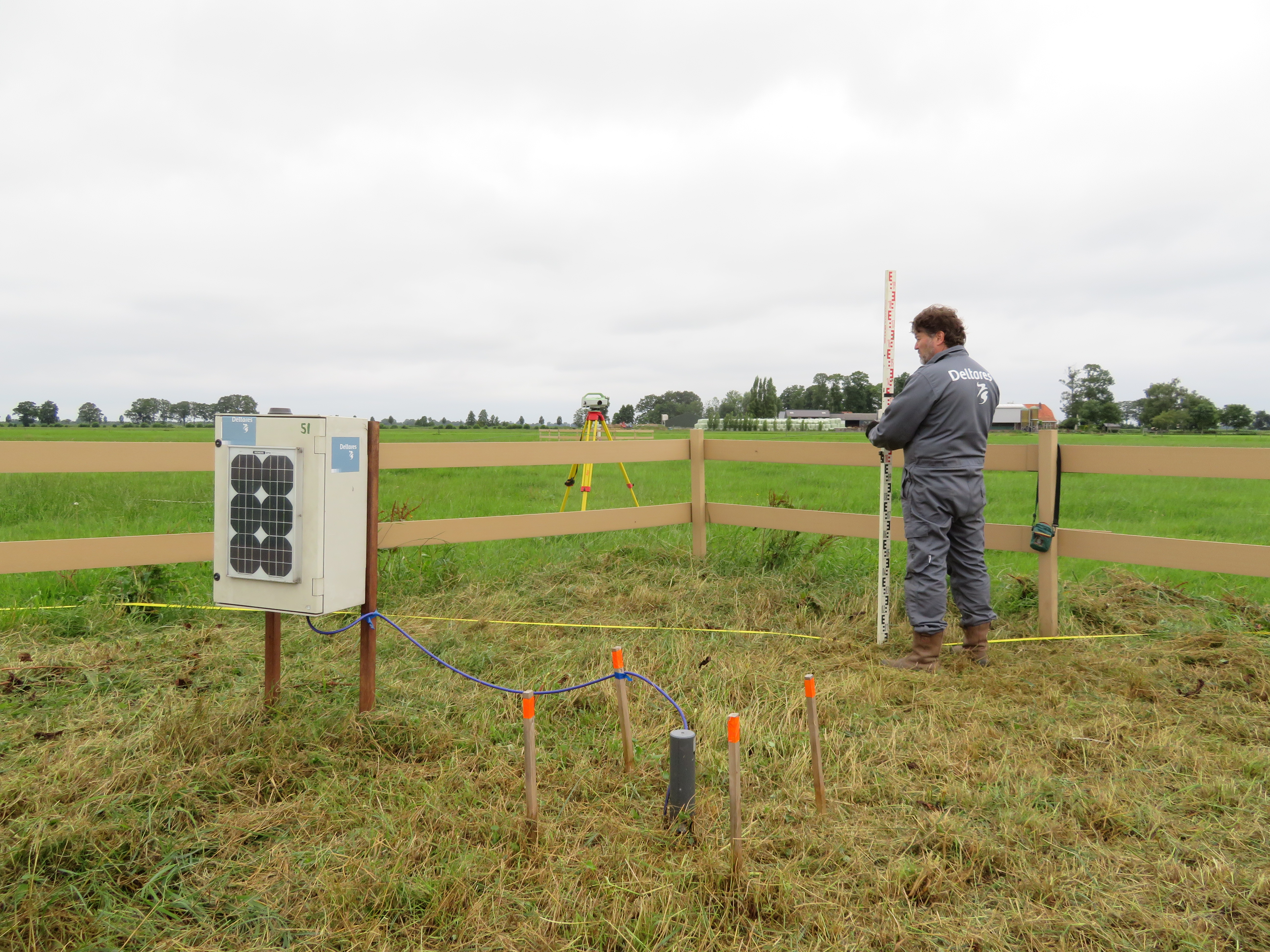
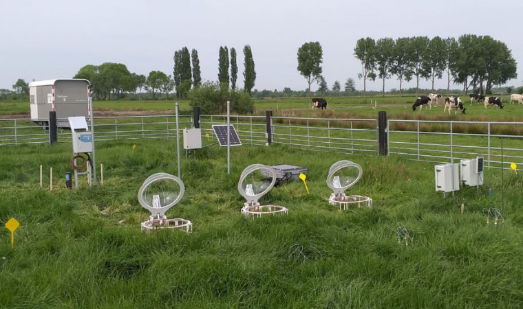
Monitoring locations
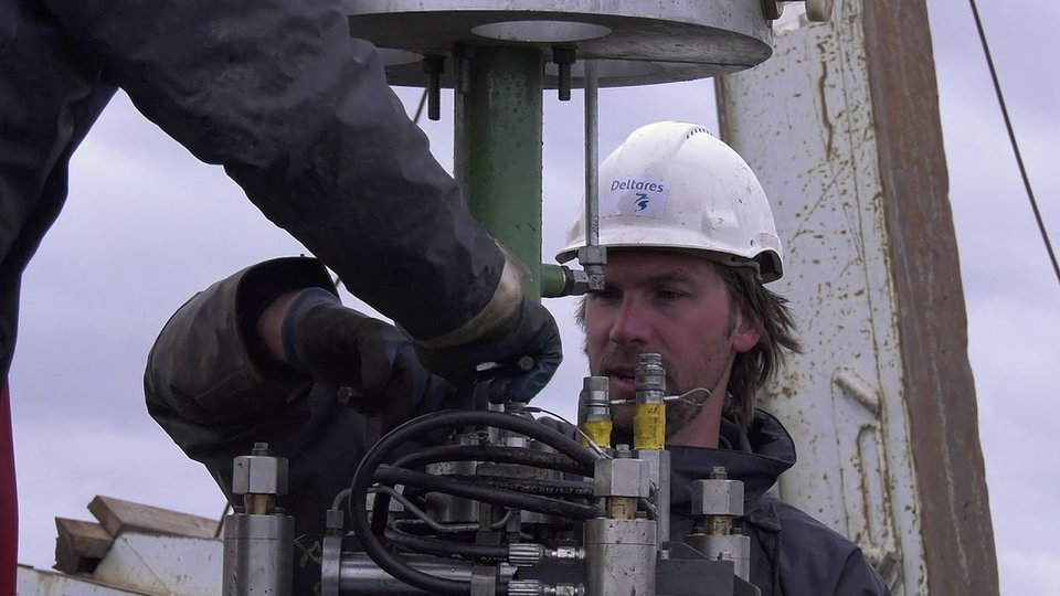
The Dutch National Research Programme on Greenhouse Gases in Peatlands began in 2019: Deltares is working with research partners to set up monitoring locations at various places in the Dutch peatlands. The programme also includes geo-engineering tests to study the strength and stiffness of the soil.
On the basis of these measurements and tests, effective measures can be taken to slow down land subsidence and greenhouse gas emissions, says Erkens. “Measures had already been planned but they are now being revised in some respects.” The monitoring showed that some measures to slow down land subsidence cannot be used in every peatland area.
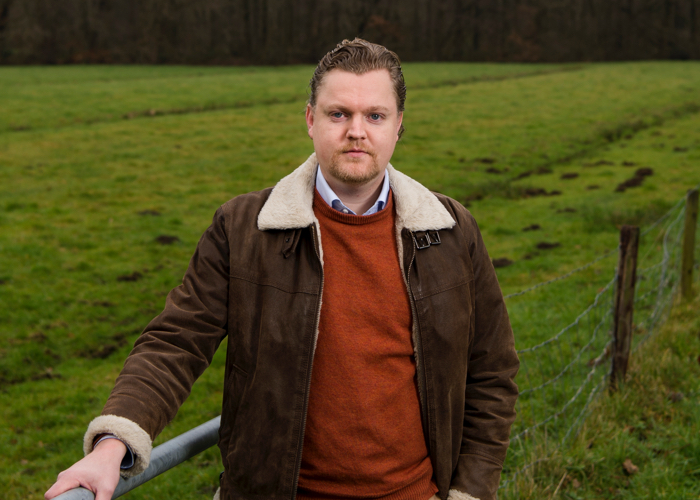
Gilles Erkens
Deltares researcher
Gilles Erkens is a geologist who specialises in land subsidence. He has accumulated experience in this field throughout the world in countries including Indonesia, the United States, Russia, Germany, Brazil and Vietnam. Gilles is a member of the Deltares Scientific Council and here is also a senior researcher at Utrecht University.
“The effectiveness of measures depend on the conditions where you apply them: the location itself, the implementation method and the management arrangements. And it depends on the weather: a measure can work better in some years than in others. Last year was so dry that some infiltration measures didn’t help to get the water into the subsurface. The year before that was very wet and so there was a lot of water in the ground. A tailored approach makes it possible to calculate the effects better.” Deltares developed the SOMERS registration system with its partners to monitor the reduction of emissions from the peaty soil. Carbon emissions can be determined for each section of land – with and without measures.
The results are available online for every municipal, provincial or water authority
Nobveenweiden calculation rules SOMERS
On the basis of monitoring data and the model predictions, provincial authorities can shape their policies and achieve their ambitions to reduce greenhouse gas emissions from peatland areas by 1 million tonnes of CO2 annually by 2030.
“You have to monitor for years before you see a pattern in those fluctuations in the soil.”
Gilles Erkens - Deltares researcher
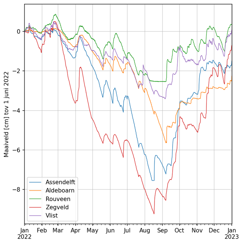
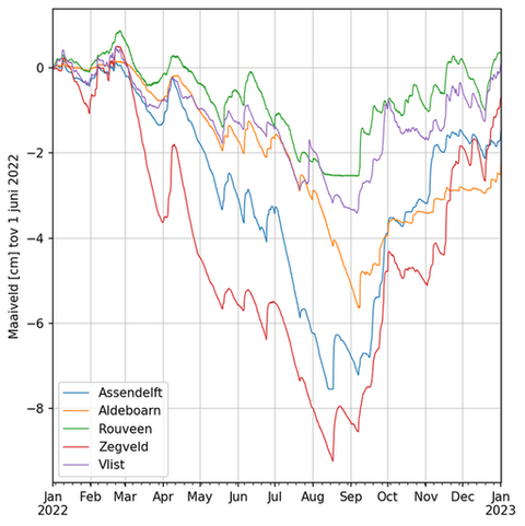
Soil breathes
The monitoring data also show that the soil changes continuously in terms of height and ‘breathes’ with the seasons. Peatland can rise or fall by six or even ten centimetres in a single year. During the dry summer last year, there was a large fall, followed by a smaller rise when the weather was wet in the autumn. “You have to monitor for years before you see a pattern in those fluctuations in the soil and determine the extent of long-term land subsidence. We need as much as a decade to establish a proper picture of what is going on.” Land subsidence in peatlands is an issue in other countries as well. Which is why Deltares looks to work with the Danish, English and German researchers and exchange knowledge with each other.

Climate Impact Atlas
The land subsidence projections in the Climate Impact Atlas provide a picture of the extent of land subsidence in the Netherlands through to 2100. Deltares updates these maps frequently with the latest knowledge.
View the subsidence projection map
Extra information
Deltares is the lead partner in the Dutch National Research Programme on Greenhouse Gases in Peatlands and one of the implementing parties for the measurement, monitoring and recording of the soil research. You can find more information at Dutch National Research Programme on Greenhouse Gases in Peatlands
Nobveenweiden
External links
Research Programme Living on Soft Soil (LOSS)
More information
Gilles Erkens
Expert land subsidence