Understanding and predicting extreme flooding
Worldwide, densely populated areas are prone to flooding. This already affects hundreds of millions of people per year, a number which will continue to increase due to population growth and climate change. Recent examples are disasters such as flooding in Australia and in Mozambique. The combination of high tides, storm surges, waves, river discharges and rainfall, makes it challenging to manage flood risk and design strategies for risk reduction.
Improving statistical methods and models
Using our knowledge of the water and subsoil system, Deltares develops and improves statistical methods and numerical simulation models to determine extreme storm surges and tides, waves and river discharges. Deltares uses unique and innovative numerical and data-driven models, such as DHydro1D-2D, Delft3D-FM, SFINCS, XBeach and BEWARE to simulate scenarios of flooding and concurring hazards, and tools such as FIAT, RA2CE and CIrcle to quantify and visualize subsequent damages and cascading effects. The tools provide actionable information to governments, NGOs and citizens worldwide to assess flood risk and to plan mitigation measures to protect flood prone populations in a cost-efficient, sustainable and equitable way.
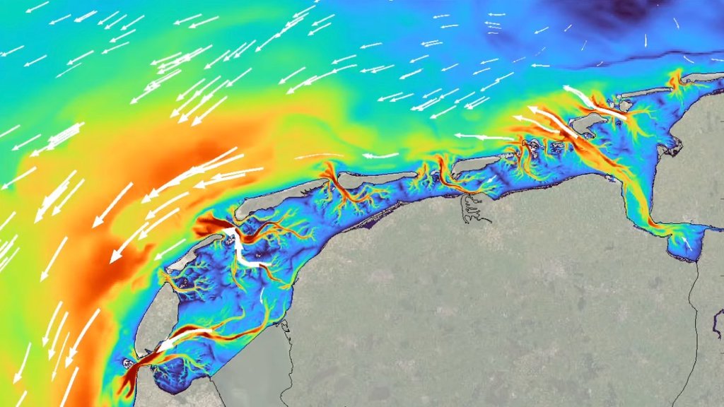
Waterlevels and velocities in the Wadden Sea and North Sea computed with a Delft3D-FM model
For example, together with Delft University of Technology we improve our understanding and prediction of waves that penetrate into the Wadden Sea and attack the mainland dikes. With these improved tools and the knowledge, the Dutch government and water authorities are able to better assess flood defences and save society millions in averted renovation costs.

'Our partnership with Deltares delivers a technology that bridges multiple flood types and the expertise of local stakeholders has helped hone the software to make it an effective community planning tool'
Dr. David Alexander, Department of Homeland Security; Science & Technology senior science advisor for resilience. Source: www.dhs.gov/science-and-technology/
Identifying flood prone areas to reduce flood risk
Internationally, we have made thorough system analyses of flood-prone areas, using locally acquired and remote-sensed data of the terrain, subsurface, and weather conditions. By using our knowledge and applying our models, Deltares has provided governments in Mozambique, Rwanda and Senegal with insight into flooding- and erosion risks. The modelling output provided evidence-based advice to assess the effectiveness of traditional and nature-based flood-reduction solutions.
The coastal risk analysis obtained using the CoSMoS system, which we helped develop with our long-term partner US Geological Survey, has provided key input for the adoption of US$3.7 Billion California Climate Resilience Package which will fund climate adaptation measures to be implemented over the next three years.
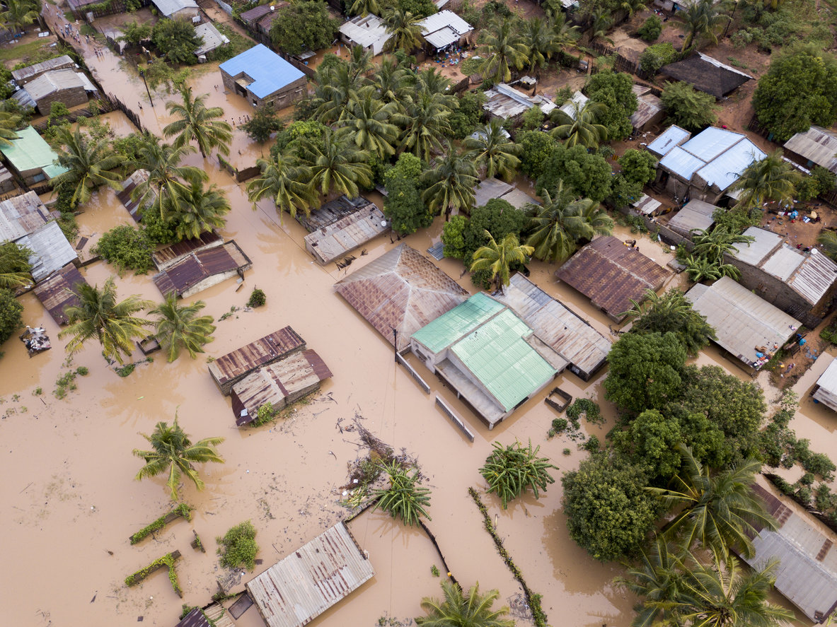
Flooding of the city of Beira (Mozambique) due to an extreme cyclone using the SFINCS model
Realizing impact
The tools that Deltares has developed to improve our understanding and prediction capacity to reduce flood risks are open source and free of charge. This has resulted in large user-communities worldwide for our software. For instance, the Delft3D open source community consists of 30.000+ members in 163 countries who use the software in their research and consultancy. We publish and present our results – often with clients – in open access literature and at conferences to engage academics and government agencies, resulting in hundreds of papers. To enable uptake and implementation, Deltares provides regular training for government, private sector, and academic professionals.


View SDGs


View Dutch missions

View Sendai Framework
More information

Robert McCall

Ferdinand Diermanse
